01
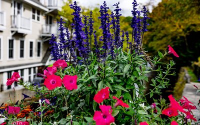
Still in the canopy
Fog in the crowns and color underneath. The ridge is the reason you started, and the forest is not ready to show it.

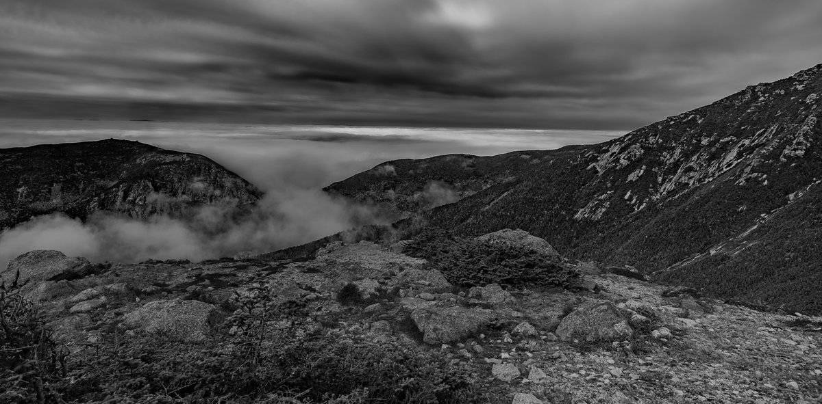
The Franconia Ridge Loop isn't just one of the most spectacular hikes in the White Mountains—it's a photographer's dream. Provided you are able to handle some type of pack with equipment and properly hydrated and fueled. This quasi technical 8.9-mile alpine traverse delivers the complete visual package: dramatic peaks disappearing into clouds, color contrasts between ancient granite and hardy vegetation, and expansive summit views that demand to be captured. I came to photograph the immensity of this landscape. The challenging vertical gain and exposed terrain were simply the price of admission. As with any hike or run the major concern is physical safety and preparation and knowing your limits. Throw a camera into the mix, including a phone it's more important to stick to the basics.
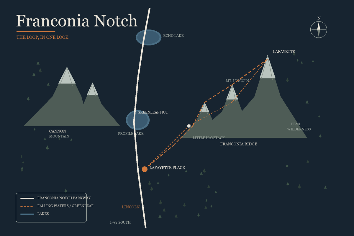
Keep it simple. The parkway is the spine. The loop leaves Lafayette Place, climbs Falling Waters to the ridge, and comes back on the Greenleaf Trail past the hut. Cannon sits west of the notch. The Pemigewasset is the country east of the ridge. Pay close attention to trail closures because this can alter your expectations and time factors.
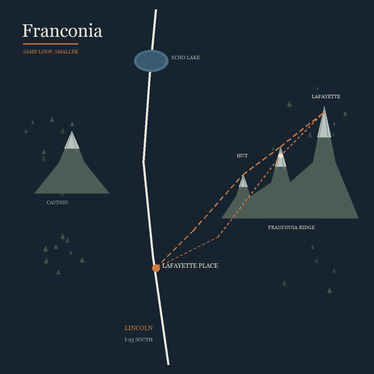
Same loop, drawn smaller for a phone. Lafayette Place is the orange dot. Lincoln is south, on I-93.
Camping @ Lafayette Place Campground in Franconia Notch State Park made the trek a little easier, since trailhead parking fills up rapidly. I started the climb from the Falling Waters trailhead relatively late (for me- because I went to Lincoln for breakfast). Within the first two miles, the gain exceeds 2,000' elevation through dense forest—camera gear adding weight to an already punishing gradient. A trail detour kept views limited through most of the ascent, testing patience when you're carrying camera equipment specifically for those views. It's a long climb with limited photographic reward, the forest canopy obscuring what you came to capture. Having done many climbs my preference is to get to the summit first and then take the full frame out. Saving the best for low light compositions on the way down. As far as phone camera use- I call those shots my insurance policy. While there a few in this post, my Archive work is all full frame (and drone images). The phone is also great for quick clips to catch contrast, movement and immensity of the location.
The climb, still under the trees. Limited views but with color contrast.
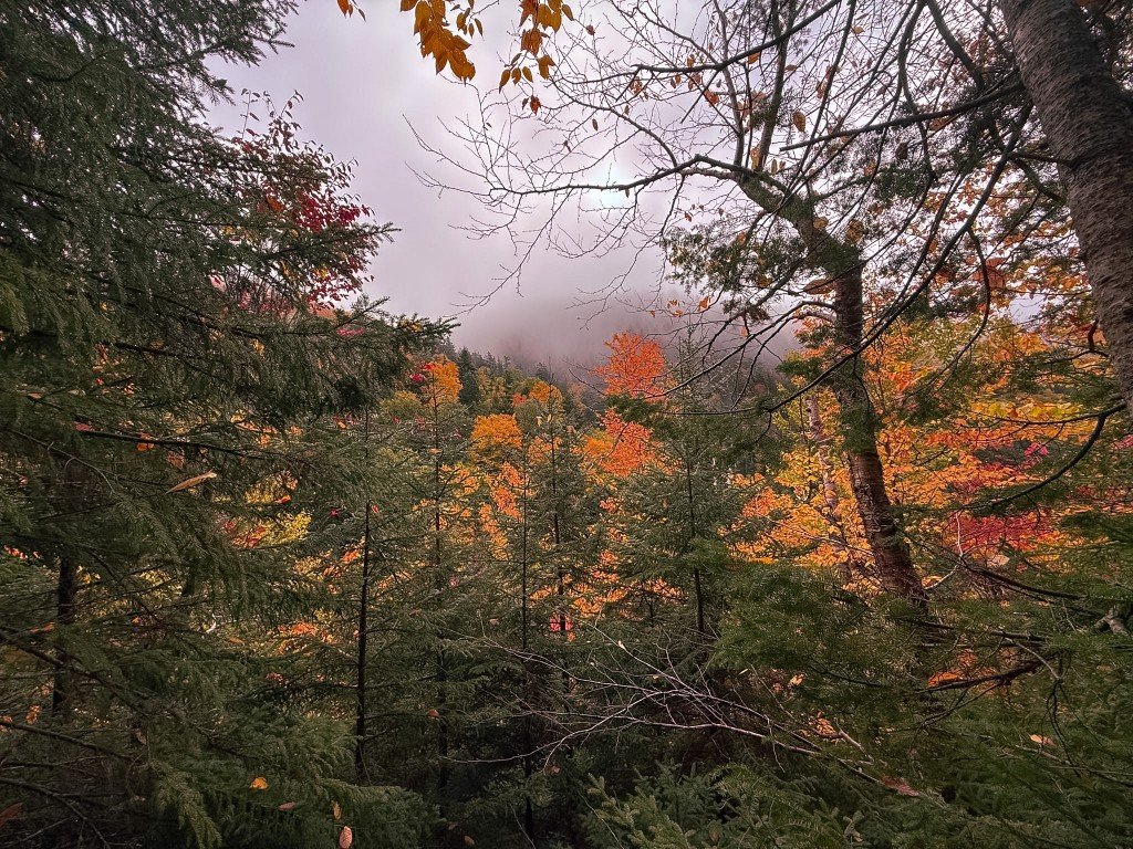
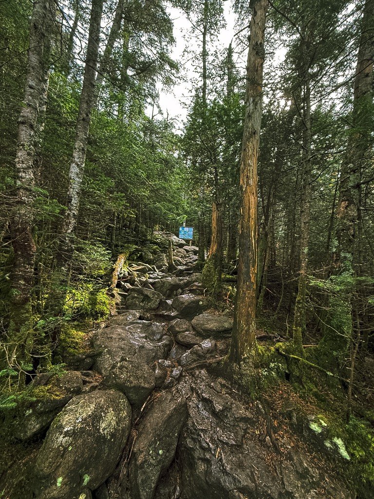
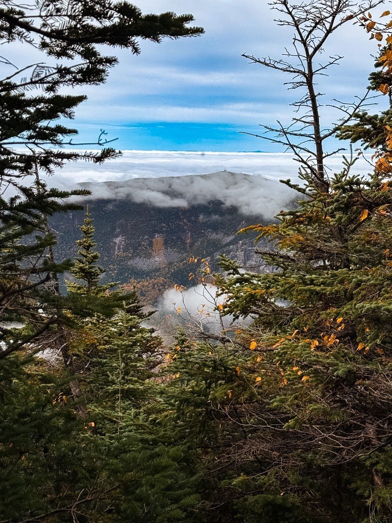
Fog in the crowns and color underneath. The ridge is the reason you started, and the forest is not ready to show it.
Wet granite, roots, and a blue blaze. Two thousand feet of this, with the camera adding weight and the view still a rumor.
Still on the way up, still in the trees. A clouded summit shows through the branches. The ridge is ahead, and this frame is not from it.
The trail demands more than endurance—it requires calculated movement with expensive equipment on your back. Hand-over-hand scrambling through steep granite faces becomes a balancing act: protect the camera, maintain three points of contact, find angles that capture the exposure without becoming part of it. The vertical perspective, the dramatic angles, the sense of scale — that part of the day is the walk, and the pictures start again once the trees are gone.
Breaking through treeline isn't gradual—it's a threshold. One moment you're in forest, the next you're standing on another planet. The landscape explodes into photographer's paradise: weathered gray granite against impossibly green lichen, deep blue sky meeting golden rock, hardy alpine vegetation clinging to cracks in compositions that write themselves. This section crosses the legendary Appalachian Trail, where thousands of thru-hikers pass each year, though most move faster than photographers stopping for every angle.
From this vantage point, the immensity unfolds in every direction. The trail narrows to a rocky spine barely wider than a sidewalk, offering 360-degree compositional opportunities with nothing but air on either side. To the east, the Presidential Range creates layered silhouettes. To the west, valleys drop away thousands of feet, their floors lost in atmospheric haze that adds depth to every frame. The scale is humbling—and impossible to convey without being here, camera in hand.
Four frames from above the trees, in the order they were made.
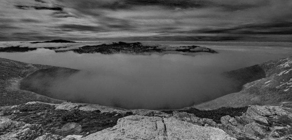
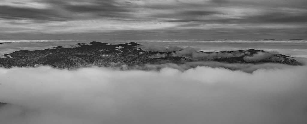
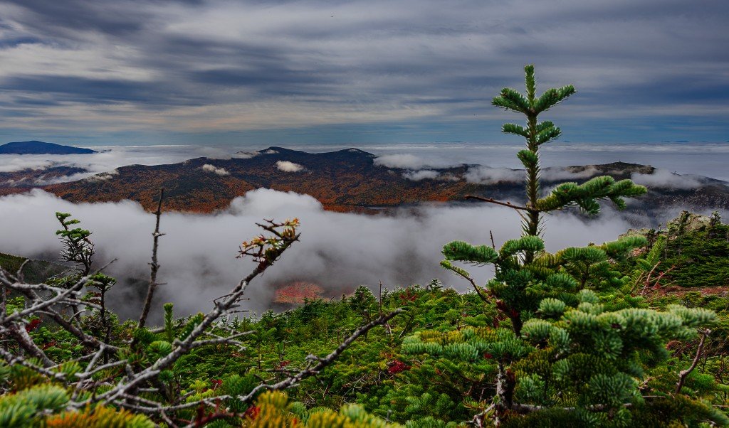
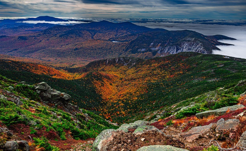
Above the trees. Rock underfoot, and the valley replaced by a bowl of cloud.
The long ridge, riding a sea of cloud. Shape and weather. Nothing else in the frame.
Fir stunted by the alpine. Cloud pouring through the valleys, fall color on the slopes below.
Heath, granite, and the notch still holding a bank of cloud on the horizon.
At 5,260 feet, Mt. Lafayette's summit is the ultimate reason for this trek. The 360-degree views are staggering: layer upon layer of mountains extending to every horizon, peaks fading through progressively softer blues and purples—exactly the color gradation that makes landscape photography sing. On a clear day, you can capture four states in a single panoramic sweep.
What makes Lafayette extraordinary is the variety of angles. Walk the summit cairn and each step is a different composition: the knife-edge ridge you just traversed, leading lines back through the walk; the imposing bulk of Mt. Washington to the northeast, often crowned with its own weather system; the Pemigewasset Wilderness spreading endlessly southward, an ocean of green punctuated by distant granite peaks.
But the window is finite. Within thirty minutes of reaching the top, low clouds moved in.
Above treeline, weather moves fast. What began as clear summit views transformed within half an hour as low clouds rolled in from below, swallowing the valleys first, then rising to engulf the peaks. The temperature dropped. Wind increased. And the photographic opportunity completely changed—not worse, just different.
This is alpine photography: you don't control the conditions, you document what arrives. The clouds create their own drama—peaks disappearing and reappearing, atmospheric veils reshaping compositions moment by moment, light breaking through at impossible angles when gaps appear. You're not just capturing landscapes; you're documenting weather systems in motion, the exact interplay of mountain and cloud that exists right now and may never repeat exactly.
The speed of change demands both technical readiness and risk assessment: shooting quickly when conditions allow, protecting gear from moisture, monitoring weather progression to stay safe. The mountain makes its own rules. You adapt or you leave. But those who work with the changing conditions—rather than against them—capture something real: the mountain as it actually is, not as we imagine it should be.
The sign, then the hut. The walk down comes after this.
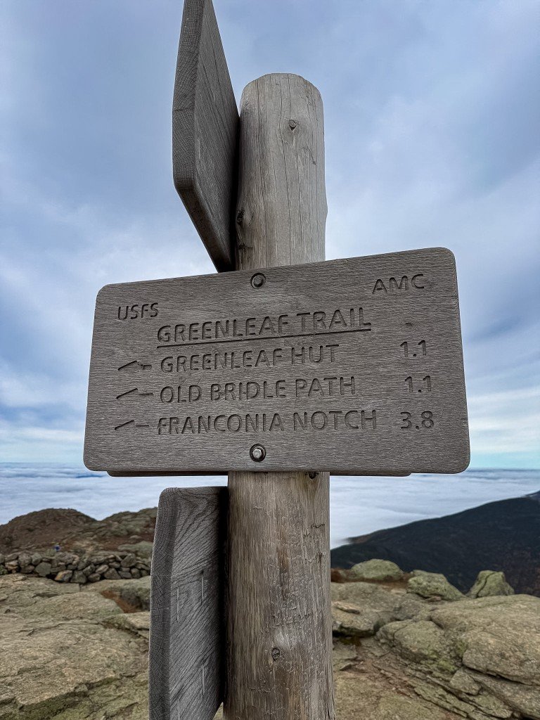
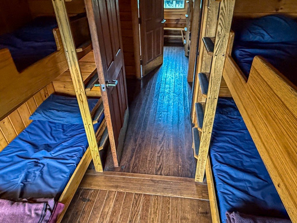
The hut is 1.1 miles ahead on the descent. Old Bridle Path, 1.1. Franconia Notch, 3.8. Relatively easy hike from this point down to the hut.
The bunkroom at 4,220 feet. Blue pads, wooden ladders, and a pocket of order in weather that does not care. Considering the location it feels like you're in a country club.
The sign and the hut belong together, and they come before the walk down. Greenleaf Hut is 1.1 miles. Old Bridle Path is the same. Franconia Notch is 3.8.
Just below Lafayette, the hut is the contrast that makes the place legible: stone and timber against the granite, a deck where hikers stop, a crew that spends the summer at 4,220 feet. Inside, the bunkroom is that idea with the romance stripped off. Blue pads, wooden ladders, a narrow aisle of warm light.
The loop descends via the Greenleaf Trail, dropping nearly 3,000 feet in less than three miles back toward Lafayette Place Campground. By this point the legs are spent. The trail is relentless: roots, rocks, occasional wooden staircases, all demanding focus when your body is ready to quit. The pictures from here are the walk down — the valley you are dropping into, then the canopy itself.
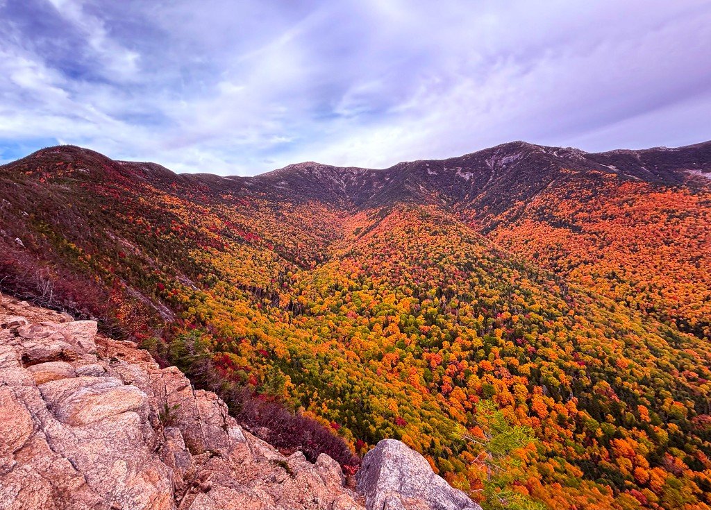
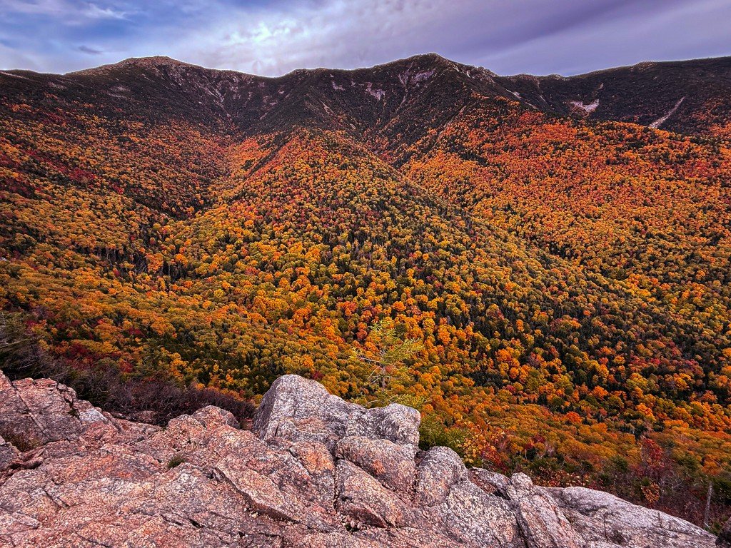
In the order they were made. The rock, the valley, then the canopy.
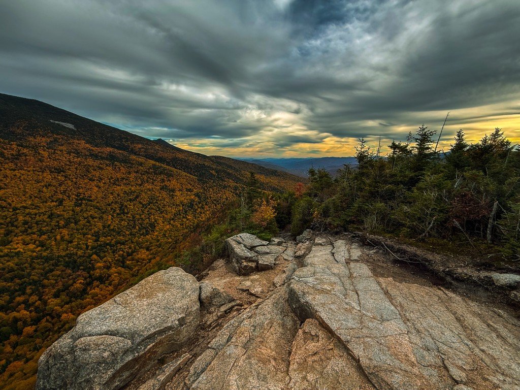
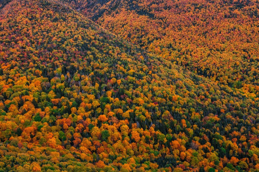
The way down. Granite in the foreground, a heavy sky, and the valley you are walking into.
From the edge. The slope is already in full color, and the trail is dropping into it.
A lower angle on the same drop. The boulders hold the foreground. The color takes the rest. Although I had a headlamp and as well experienced in night descents since it was first time on this route opted to complete before sunset.
Farther down, the subject is the forest itself. Tight color, no sky, the last of the descent.
By the time you reach the trailhead, you've hiked one of the finest loops in the eastern United States. More importantly, you've captured it—exactly as it was, in the brief window when conditions allowed.
The Franconia Ridge Loop isn't for everyone. It requires solid fitness, scrambling ability with camera gear, basic skills, and the judgment to balance photographic ambition with weather reality. The views you climb for may only last thirty minutes. The ascent may offer limited photographic opportunities until you break through treeline. The clouds will move on their schedule, not yours.
But for photographers willing to carry their equipment into serious alpine terrain and shoot what the mountain provides when it provides it, the rewards are extraordinary: the dramatic moment when treeline opens up, peaks disappearing into clouds on the mountain's timeline, color contrasts that shift with rapidly changing light, compositions that capture genuine scale and drama, and the truth of alpine conditions—beautiful, volatile, and utterly indifferent to your plans.
This isn't a walk in the woods. It's an alpine expedition with a camera—one that demands everything you've got, respects no schedule, and gives back images that capture exactly what happened in that brief window when mountain and photographer intersected.
Detailed route maps, conditions, and the Falling Waters relocation: Franconia Notch State Park
Base camp at Lafayette Place Campground: Franconia Notch State Park
Reservations, crew info, and current conditions: Greenleaf Hut
The ridge traverse crosses the AT: Appalachian Trail Conservancy
| Distance | 8.9 miles (loop) |
| Elevation Gain | ~3,900 feet |
| Time | 6–8 hours (add time for photography) |
| Difficulty | Strenuous / technical |
| Best Season | Late June through September |
| Trailhead | Lafayette Place Campground, Franconia Notch State Park |
Stay on trail to protect fragile alpine vegetation. Pack out everything you pack in. The alpine zone is a rare and delicate ecosystem—treat it with care. When photographing, be mindful of your impact and never trample vegetation for a shot.
While Acadia is the front door — working harbors, outer islands, seasons, …
Read More
Earlier summer into mid-fall in Millinocket — gateway to Baxter State Park, …
Read More